Table of Contents
- Why Congressional Maps Matter
- Redistricting Basics: Who Draws the Lines?
- What Makes an Electoral Map Fair?
- How District Lines Affect Louisiana Communities
- Race, Representation, and Voting Rights
- Partisan Gerrymandering and Political Advantage
- Why Maps Can Change Before the Next Census
- How Voters Can Check Their District
- Questions to Ask When a Map Changes
- Common Questions About Redistricting
- Conclusion
In Louisiana, congressional district lines do more than mark boundaries on a map. They decide which communities vote together for a U.S. House representative, whose local concerns are heard by the same office, and which candidates appear on a voter’s ballot. In a state where river parishes, coastal towns, rural areas, growing suburbs, and major cities often face very different priorities, those lines can have practical consequences.
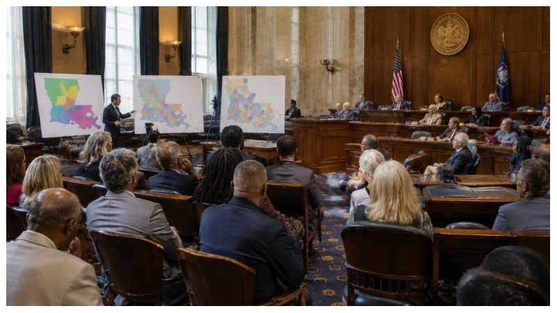
Questions about Louisiana’s map became especially visible during the litigation surrounding congressional districts and voting rights. For background on that dispute, readers can learn more about the case here. Regardless of a voter’s political views, understanding how maps work makes it easier to follow changes that affect representation.
Why Congressional Maps Matter
Every Louisiana resident lives in a congressional district, and each district elects one member of the U.S. House of Representatives. If a boundary moves, a family can remain in the same home but become part of a different district. That change may place neighbors on opposite sides of a line, represented by different offices and voting in different congressional contests.
Representation is not only about elections. Residents contact congressional offices about federal agencies, disaster assistance, veterans’ benefits, flood insurance, passports, infrastructure, and other concerns. A district that combines several distinct places may require one representative to balance the needs of communities that do not always face the same challenges.
Redistricting Basics: Who Draws the Lines?
Redistricting is the process of redrawing electoral districts. It is different from reapportionment, which is the allocation of U.S. House seats among states after the census. After reapportionment, states draw the boundaries for the seats they have received.
The decennial census usually begins the redistricting process because population counts help states create districts with roughly equal numbers of people. The Census Bureau’s redistricting data program provides population information that states use when evaluating new boundaries. In Louisiana, the Legislature generally plays a central role in congressional mapmaking, while courts may review maps challenged under constitutional or federal voting-rights standards.
What Makes an Electoral Map Fair?
There is no single test that answers every fairness question, but mapmakers and courts commonly examine several factors:
- Whether districts have reasonably equal population.
- Whether districts comply with the U.S. Constitution and applicable federal and state law.
- Whether each district is connected rather than made up of detached pieces.
- Whether maps respect parish, municipal, neighborhood, and community boundaries when practical.
- Whether the plan unlawfully weakens the voting strength of racial or language minority communities.
- Whether the public can see proposed maps, data, hearings, and final decisions.
How District Lines Affect Louisiana Communities
Louisiana’s geography makes district design especially consequential. A coastal community may prioritize hurricane protection, wetlands restoration, fisheries, and flood recovery. A rural parish may focus on agricultural policy, hospital access, roads, or broadband. Residents of Baton Rouge, New Orleans, Shreveport, Lafayette, and fast-growing suburban areas may bring different concerns to the same congressional office.
Keeping a community together does not guarantee agreement among its residents. It can, however, make it simpler for people with shared local concerns to organize, communicate with one representative, and evaluate that representative’s response.
Race, Representation, and Voting Rights
Race may be relevant in redistricting because the Voting Rights Act prohibits voting practices, including district plans, that discriminate on the basis of race, color, or membership in protected language minority groups. Claims involving district lines often ask whether a map gives a community a meaningful opportunity to elect its preferred candidates.
That inquiry is legally complex. Courts may consider population patterns, voting behavior, the history of a jurisdiction, and the overall effect of a map. It is important to distinguish between evaluating whether minority voting strength has been diluted and assuming that every voter of a particular race shares the same political preference.
Partisan Gerrymandering and Political Advantage
Partisan gerrymandering refers to drawing district lines to favor one political party. Two commonly discussed tactics are packing and cracking. Packing concentrates many like-minded voters into a small number of districts, while cracking divides them among several districts where they may be outvoted.
A map does not need to have dramatic or irregular shapes to create political advantages. The key question is often how the boundaries distribute voters across districts, not simply whether the map looks visually tidy.
Why Maps Can Change Before the Next Census
Most redistricting follows the census, but congressional maps can change between census cycles. A court order, a successful legal challenge, a change in state law, or legislative action can lead to a replacement map. Mid-decade changes can affect candidate plans, campaign outreach, voter education, and the information election officials must provide.
How Voters Can Check Their District
- Use the Louisiana voter portalto review information connected to your registration.
- Confirm your address and the districts listed for your record.
- Review your sample ballot when it becomes available for an election.
- Compare mailed election information with your online record.
- Contact your parish election office if the information appears inconsistent.
Questions to Ask When a Map Changes
- Who drew or approved the map?
- When does the new plan take effect?
- Which parishes, neighborhoods, or municipalities were split or combined?
- Were public hearings and map data available for review?
- Has the map been reviewed in court?
- How could the change affect the candidates and contests on local ballots?
Common Questions About Redistricting
Can my congressional district change even if I do not move?
Yes. A redrawn boundary can place the same address in a different congressional district without changing a voter’s residence or registration.
Does a new map cancel voter registration?
Usually, no. A map change generally affects district assignments and ballot contests rather than whether a person remains registered. Voters should still verify their records before participating in an election.
Why should residents pay attention to map rules?
Map rules help residents evaluate claims about fairness, representation, population balance, and voting rights. They also provide useful context when campaign messages or social media posts present only part of a proposed map.
Conclusion
Congressional maps shape who represents Louisiana communities and how those communities build political influence. By checking official voter information, following public map discussions, and asking clear questions about boundaries, residents can better understand how redistricting affects their voice in Congress. Click here for more Information.